 ENEA Antarctic Data Center
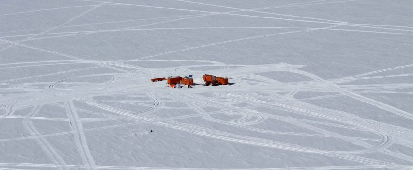
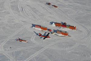
Dome C
Type of resources
Topics
INSPIRE themes
Keywords
Contact for the resource
Provided by
Formats
Representation types
Update frequencies
status
Scale
-

Since 1998, ENEA (Italian National Agency for New Technology, Energy and the Environment) has been carrying on researches to develop a plant based greenhouse facility for producing plant fresh food at the Italian bases of TNB (Terra Nova Bay) and Dome C (Concordia base) in Antarctica. Accordingly, at the base TNB “Mario Zucchelli” was installed a sustainable closed greenhouse facility PULSA (Plant-based Unit for Life Support in Antarctica). PULSA has been in operation during four campaigns in Antarctica. 1) A complete automatic hydroponics system for plant cultivation in artificial environmental (C.H.G.S., Closed Hydroponic Greenhouse System); 2. A closed module PULSA Unit. A prototype greenhouse module has been conceived and designed as a transportable unit made of a standard container, dimensions of 6055 (l)*2435(w)*2585(h) mm. The installed microclimate conditioning unit included an air heater of about 6.0 kW which can also act as inside air cooling as well as dehumidifier for removing the internal humidity (up to 2.5 kg/h of water) by forcing the air into a drying service. An air ventilation device composed of two fans each of 400 W and air capacity exchanging of 1200 m3/h was also installed to keep necessary air exchange and CO2 concentration. 3) A treating and recycling wastes unit for the purification of water and for the recycling of residual biomass wastes from the hydroponic cycles, 4) A complete automated and remote-controlling system for the germination and the production of the plantlets (Box-Nursery); 5) A simulator for the growth and the yield production of lettuce (SLS) in function of the temperature and the light applied to the crops. Other prototypes still under developing are: a) the multilevel hydroponics design; b) the solar photovoltaic system of 1.1 kWp, to optimize the yield and the autonomy of the enclosed growing volume using artificial and/or Light Emitting Diodes (LEDs) as light sources for plant crop growth. Considerations and comments are reported on the on-going challenge to use PULSA as scientific platform for implementing activities of research and demonstration on plant growth technologies for Space.
-
The project aims to determine the mass balance components in the Dome C drainage area and to study and monitor local glaciers in Victoria Land. The goal is to define the mass balance of the ice cap through the analysis of its altimetric variation with satellite systems and through the determination of the values of the positive (snow accumulation) and negative (flow of glaciers to the anchor line) components of the balance mass. Trought the study of the snow cores (collected as part of the ITASE project (XVII/XVIII expedition)), was determined the annual stratigraphy and evaluated the snow accumulation, the isotopic temperature and the chemical composition of the snow cores. Moreover analysis of geophysical data (GPR, GPS, RES, spectroradiometry) and remote sensing data were carried out for the study of the variability of snow accumulation, of the dynamics of the ice cap and of the flow of glaciers to the anchor line.
-
The project aims to estimate the current mass balance of glaciers and in particular of the Antarctic ice sheet by studying the space-time variations of the balance of snow accumulation through the integration of meteo-climatic and glaciological data. Analysis of weather-climatic and snow measurements collected by AWS stations (Dome C, C3, High Priestley, Talos Dome and a Nansen Ice Sheet) using sensors for measuring snow transport and measuring poles. Snow radar data collection of the Dumont d’Urville-Dome C traverse. Analysis of the chemical and isotopic composition of the collected snow samples. Analysis of satellite data to define the path of the Talos Dome-Dome C-Vostok-Dome B-Dome A crosspiece. High resolution chemical / isotopic analyzes (samples in trenches) for the study of post-depositional diffusion / re-emission processes that occur in the part of the snow closest to the surface. Study of the spatial variability of the snow accumulation at the TD site and along the ITASE traverse. Continuation of the analysis of the samples and geophysical data collected in the previous ITASE traverses.
-
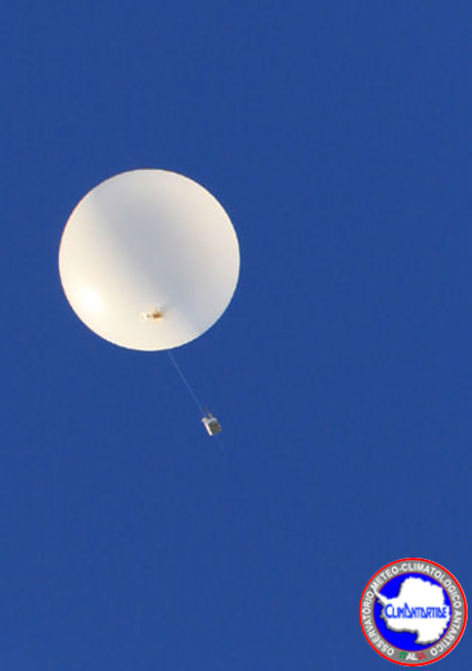
Monitoring of climate data in the area of the Concordia station, at Dome C, from the XXXIV Antarctic campaign using radiosonde system (RDS) DOMEC. The climate parameters monitored are: Height (gps position), Pressure, Temperature, Humidity, Velocity of wind, Direction of the wind. The data are obtained doing upper-air measurements. Data are collected every day at 12UTC, all year round. The DOMEC is active since 2006-01-19. The RDS (VAISALA RS92) is launched into the atmosphere coupled to a balloon inflated with helium. The sonde rises with a speed of about 2-5 m / s up to a height of between 20 and 25 km. During the ascent all the parameters are acquired. The data obtained are coded both in a digital format (BUFR) and in text format and entered into the global network (GTS) of the World Meteorological Organization (WMO).
-
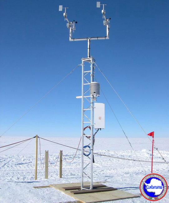
Acquisition of metereological data, in the area of the Concordia station, from the XXXIV Antarctic campaign. The meteorological parameters monitored are: temperature, pressure, relative humidity, wind speed and direction, further data acquired are heated wind sensor Speed, heated wind sensor Direction, Sonic sensor. Standard surface measurements. The data are acquired through an automatic weather station 'Concordia' at Dome C (3 233 a.s.l.). This data collection is carry out every hour and every minute, all year round. Data are transmitted via the ARGOS satellite system throughout the year. It has been part of the historical data collection series since 2005 (XXcampaign: activation of Concordia station).